Via de la Plata
ESBest monthsJanFebMarAprMayJunJulAugSeptOctNovDec
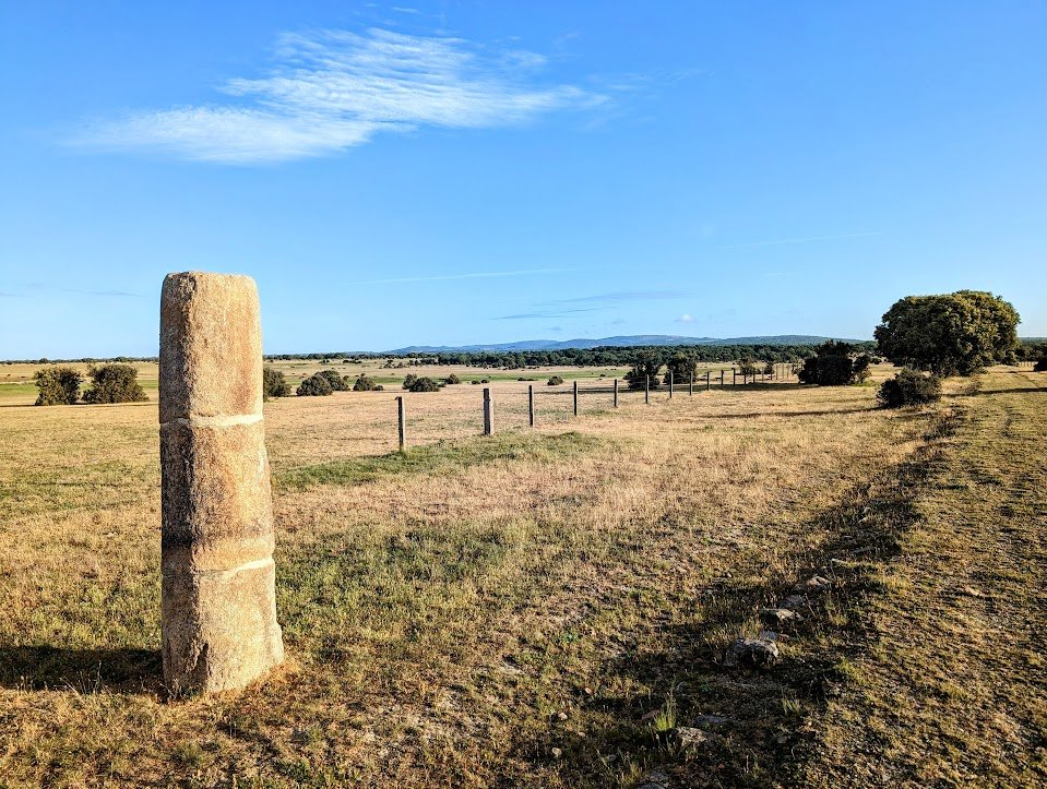
The Via de la Plata follows one of Spain’s oldest roads, crossing vast interior landscapes shaped by history and time. Roman milestones, quiet villages, and open horizons define the journey. Less traveled than other Camino routes, it offers a slower, more solitary experience — a continuous path through the heart of Spain toward Santiago de Compostela.
Stages
| 1 | Casco Antiguo - Guillena | 23.2 km | ↗ 205 m |
| 2 | Guillena - Castilblanco de los Arroyos | 17.9 km | ↗ 425 m |
| 3 | Castilblanco de los Arroyos - Almadén de la Plata | 28.1 km | ↗ 692 m |
| 4 | Almadén de la Plata - Monesterio | 33.9 km | ↗ 1,063 m |
| 5 | Monesterio - Fuente de Cantos | 20.6 km | ↗ 273 m |
| 6 | Fuente de Cantos - Huerta Plata | 24.1 km | ↗ 236 m |
| 7 | Huerta Plata - Villafranca de los Barros | 19.9 km | ↗ 270 m |
| 8 | Villafranca de los Barros - Torremejía | 27 km | ↗ 97 m |
| 9 | Torremejía - Carcesa | 15 km | ↗ 108 m |
| 10 | Carcesa - Aljucén | 16.8 km | ↗ 334 m |
| 11 | Aljucén - Alcuéscar | 19.2 km | ↗ 370 m |
| 12 | Alcuéscar - Aldea del Cano | 15.2 km | ↗ 72 m |
| 13 | Aldea del Cano - Plaza Mayor | 22.3 km | ↗ 292 m |
| 14 | Plaza Mayor - Casar de Cáceres | 12.2 km | ↗ 221 m |
| 15 | Casar de Cáceres - Cañaveral | 34.2 km | ↗ 759 m |
| 16 | Cañaveral - Galisteo | 26.4 km | ↗ 614 m |
| 17 | Galisteo - Guijo de Granadilla | 29.6 km | ↗ 427 m |
| 18 | Guijo de Granadilla - Baños de Montemayor | 30.6 km | ↗ 675 m |
| 19 | Baños de Montemayor - Fuenterroble de Salvatierra | 32.5 km | ↗ 1,110 m |
| 20 | Fuenterroble de Salvatierra - San Pedro de Rozados | 28 km | ↗ 573 m |
| 21 | San Pedro de Rozados - Salamanca | 23.5 km | ↗ 280 m |
| 22 | Salamanca - El Cubo de Tierra del Vino | 37.2 km | ↗ 345 m |
| 23 | El Cubo de Tierra del Vino - Barrio La Lana | 31.5 km | ↗ 225 m |
| 24 | Barrio La Lana - Montamarta | 19.9 km | ↗ 203 m |
| 25 | Montamarta - Granja de Moreruela | 22.7 km | ↗ 251 m |
| 26 | Granja de Moreruela - Benavente | 27.4 km | ↗ 301 m |
| 27 | Benavente - Alija del Infantado | 21 km | ↗ 235 m |
| 28 | Alija del Infantado - La Bañeza | 23.1 km | ↗ 165 m |
| 29 | La Bañeza - Astorga | 24.5 km | ↗ 236 m |