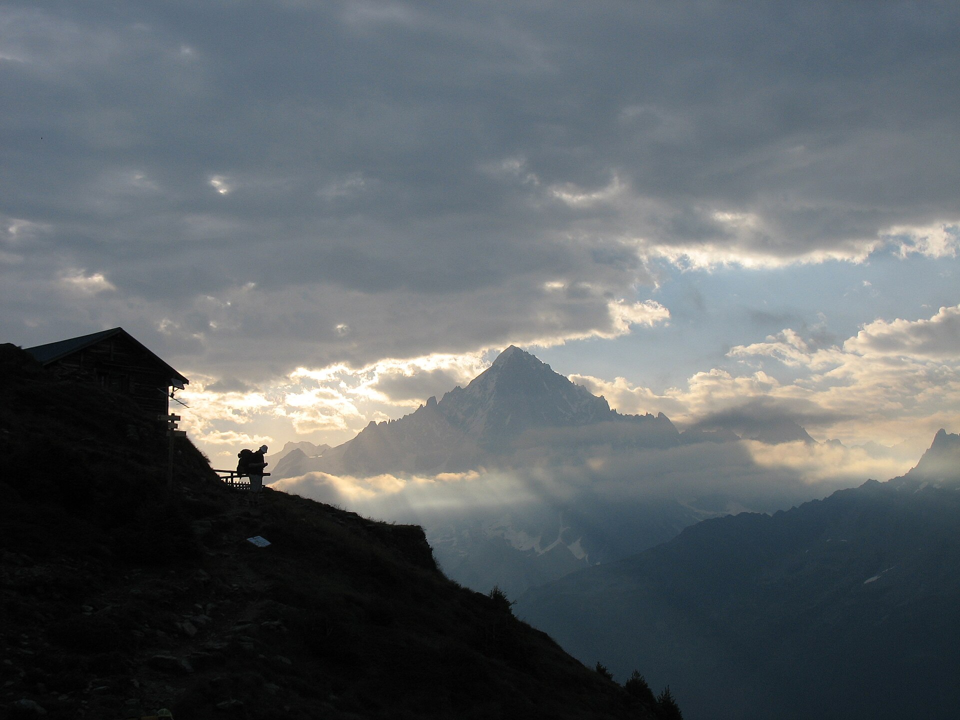
Photo: Jérôme Tcherniatinsky · Wikimedia Commons · Public domain

GR 5
NLBELUFRThe GR 5 is a GR footpath that starts in the Netherlands, crosses Belgium and Luxembourg before crossing France from north to south. It is part of the European walking route E2. This trail is famous for its route through the French Alps from Lake Geneva to Nice called Grande Traversée des Alpes.
Stages
| 1 | Hoek van Holland → Maassluis | 22.8 km | ↗ 38 m |
| 2 | Maassluis → Oostvoorne | 20.5 km | ↗ 32 m |
| 3 | Oostvoorne → Havenhoofd | 22.5 km | ↗ 40 m |
| 4 | Havenhoofd → Herkingen | 21.7 km | |
| 5 | Herkingen → Nieuw-Vossemeer | 24.4 km | ↗ 15 m |
| 6 | Nieuw-Vossemeer → Bergen op Zoom | 19.6 km | ↗ 39 m |
| 7 | Bergen op Zoom → Huijbergen | 16.5 km | ↗ 41 m |
| 8 | Huijbergen → Maria-ter-Heide | 20.2 km | ↗ 91 m |
| 9 | Maria-ter-Heide → Halle | 23.3 km | ↗ 79 m |
| 10 | Halle → Lille | 22.5 km | ↗ 106 m |
| 11 | Lille → Tongerlo | 20 km | ↗ 95 m |
| 12 | Tongerlo → Averbode | 17.1 km | ↗ 75 m |
| 13 | Averbode → Diest | 19 km | ↗ 79 m |
| 14 | Diest → Lummen | 20.6 km | ↗ 116 m |
| 15 | Lummen → Stokrooie | 18.9 km | ↗ 82 m |
| 16 | Stokrooie → Bijenberg | 20.5 km | ↗ 94 m |
| 17 | Bijenberg → Zutendaal | 19 km | ↗ 131 m |
| 18 | Zutendaal → Lanaken | 18.5 km | ↗ 141 m |
| 19 | Lanaken → Kanne | 20.6 km | ↗ 190 m |
| 20 | Kanne → Visé | 24.9 km | ↗ 329 m |
| 21 | Visé → Retinne | 18.8 km | ↗ 392 m |
| 22 | Retinne → Banneux | 19.1 km | ↗ 411 m |
| 23 | Banneux → Spa | 17.7 km | ↗ 371 m |
| 24 | Spa → Stavelot | 17.3 km | ↗ 551 m |
| 25 | Stavelot → Neuville | 18.4 km | ↗ 489 m |
| 26 | Neuville → Neubrück | 18.9 km | ↗ 241 m |
| 27 | Neubrück → Ouren | 20.7 km | ↗ 491 m |
| 28 | Ouren → Dasburg | 14.4 km | ↗ 371 m |
| 29 | Dasburg → Gemünd | 13.8 km | ↗ 567 m |
| 30 | Gemünd → Vianden | 15.8 km | ↗ 839 m |
| 31 | Vianden → Gilsdorf | 14.2 km | ↗ 365 m |
| 32 | Gilsdorf → Beaufort | 15.5 km | ↗ 415 m |
| 33 | Beaufort → Echternach | 17.4 km | ↗ 452 m |
| 34 | Echternach → Girst | 14 km | ↗ 434 m |
| 35 | Girst → Mertert | 15.2 km | ↗ 254 m |
| 36 | Mertert → Machtum | 18.8 km | ↗ 498 m |
| 37 | Machtum → Remich | 20.4 km | ↗ 523 m |
| 38 | Remich → Schengen | 17.9 km | ↗ 611 m |
| 39 | Schengen → Kemplich | 22.1 km | ↗ 333 m |
| 40 | Kemplich → Vigy | 22.7 km | ↗ 236 m |
| 41 | Vigy → Metz | 17.9 km | ↗ 151 m |
| 42 | Metz → Ancy-sur-Moselle | 17.3 km | ↗ 278 m |
| 43 | Ancy-sur-Moselle → Onville | 18.3 km | ↗ 434 m |
| 44 | Onville → Vilcey-sur-Trey | 17.8 km | ↗ 507 m |
| 45 | Vilcey-sur-Trey → Martincourt | 19.7 km | ↗ 316 m |
| 46 | Martincourt → Liverdun | 20.2 km | ↗ 277 m |
| 47 | Liverdun → Bouxières-aux-Chênes | 20.7 km | ↗ 380 m |
| 48 | Bouxières-aux-Chênes → Grémecey | 16.4 km | ↗ 254 m |
| 49 | Grémecey → Marsal | 21.3 km | ↗ 376 m |
| 50 | Marsal → Assenoncourt | 19.9 km | ↗ 63 m |
| 51 | Assenoncourt → Gondrexange | 20.8 km | ↗ 105 m |
| 52 | Gondrexange → Abreschviller | 20.9 km | ↗ 392 m |
| 53 | Abreschviller → GR 5 Vosges, Le Donon | 17.2 km | ↗ 664 m |
| 54 | GR 5 Vosges, Le Donon → Schirmeck | 14.9 km | ↗ 337 m |
| 55 | Schirmeck → le Champ du Feu | 16.3 km | ↗ 873 m |
| 56 | le Champ du Feu → Abri du Rocher du Panorama | 16.2 km | ↗ 387 m |
| 57 | Abri du Rocher du Panorama → Refuge Gruckert | 16.4 km | ↗ 582 m |
| 58 | Refuge Gruckert → Kaesmarkt | 12 km | ↗ 507 m |
| 59 | Kaesmarkt → Schaflager | 16.2 km | ↗ 442 m |
| 60 | Schaflager → Dusenbach | 14.7 km | ↗ 699 m |
| 61 | Dusenbach → Pierre des Trois Bans | 14.5 km | ↗ 935 m |
| 62 | Pierre des Trois Bans → Refuge de l'Étang du Devin | 12.6 km | ↗ 447 m |
| 63 | Refuge de l'Étang du Devin → Chalet-refuge Les Trois Fours | 18 km | ↗ 671 m |
| 64 | Chalet-refuge Les Trois Fours → Refuge HUS | 17.3 km | ↗ 831 m |
| 65 | Refuge HUS → Refuge du Storkenkopf | 13.4 km | ↗ 371 m |
| 66 | Refuge du Storkenkopf → Baecherkopf-Hislà | 17.1 km | ↗ 707 m |
| 67 | Baecherkopf-Hislà → Ski Club Sportif Mulhouse | 15.6 km | ↗ 864 m |
| 68 | Ski Club Sportif Mulhouse → Ballon d'Alsace | 17.6 km | ↗ 792 m |
| 69 | Ballon d'Alsace → Fesches-le-Châtel | 58.3 km | ↗ 767 m |
| 70 | Fesches-le-Châtel → Abbévillers | 14.6 km | ↗ 374 m |
| 71 | Abbévillers → Chamesol | 16.1 km | ↗ 561 m |
| 72 | Chamesol → Courtefontaine | 14.4 km | ↗ 623 m |
| 73 | Courtefontaine → Belfond Dessous | 17.9 km | ↗ 536 m |
| 74 | Belfond Dessous → Biaufond | 16.6 km | ↗ 600 m |
| 75 | Biaufond → Le Pissoux | 15.8 km | ↗ 633 m |
| 76 | Le Pissoux → Villers-le-Lac | 12.5 km | ↗ 627 m |
| 77 | Villers-le-Lac → Cabane du Mont Châteleu | 17.7 km | ↗ 746 m |
| 78 | Cabane du Mont Châteleu → Les Alliés | 14.1 km | ↗ 318 m |
| 79 | Les Alliés → La Cluse-et-Mijoux | 17.7 km | ↗ 502 m |
| 80 | La Cluse-et-Mijoux → Les Hôpitaux-Neufs | 20.4 km | ↗ 596 m |
| 81 | Les Hôpitaux-Neufs → Mouthe | 19.4 km | ↗ 598 m |
| 82 | Mouthe → La Maison du Montagnon | 22 km | ↗ 395 m |
| 83 | La Maison du Montagnon → Morez | 16.7 km | ↗ 467 m |
| 84 | Morez → Les Cressonnières | 14.1 km | ↗ 597 m |
| 85 | Les Cressonnières → La Vieille Faucille | 22 km | ↗ 769 m |
| 86 | La Vieille Faucille → Refuge de la Loge | 11.9 km | ↗ 586 m |
| 87 | Refuge de la Loge → Menthières | 18 km | ↗ 763 m |
| 88 | Menthières → Chevrier | 14.7 km | ↗ 288 m |
| 89 | Chevrier → Gîte d'étape l'Esperance | 11.9 km | ↗ 749 m |
| 90 | Gîte d'étape l'Esperance → Saint-Blaise | 20 km | ↗ 680 m |
| 91 | Saint-Blaise → Chalet de Pré-Berger | 16.3 km | ↗ 853 m |
| 92 | Chalet de Pré-Berger → Bonne | 18.5 km | ↗ 288 m |
| 93 | Bonne → La Salle | 14.7 km | ↗ 1,060 m |
| 94 | La Salle → Habère-Poche | 15.9 km | ↗ 773 m |
| 95 | Habère-Poche → Reyvroz | 14.4 km | ↗ 618 m |
| 96 | Reyvroz → La Montagne de Neuteu Sud | 24.7 km | ↗ 1,913 m |
| 97 | La Montagne de Neuteu Sud → Châtel | 13 km | ↗ 925 m |
| 98 | Châtel → Refuge de Chésery | 13.9 km | ↗ 979 m |
| 99 | Refuge de Chésery → Refuge de la Golèse | 14.5 km | ↗ 764 m |
| 100 | Refuge de la Golèse → Les Sprits | 16.6 km | ↗ 291 m |
| 101 | Les Sprits → Abri de berger d'Alfred Wills | 8.7 km | ↗ 1,371 m |
| 102 | Abri de berger d'Alfred Wills → Chamonix-Mont-Blanc | 12.3 km | ↗ 992 m |
| 103 | Chamonix-Mont-Blanc → Les Houches | 10.8 km | ↗ 162 m |
| 104 | Les Houches → Auberge de Bionnassay | 8 km | ↗ 683 m |
| 105 | Auberge de Bionnassay → Refuge de la Balme | 16.6 km | ↗ 912 m |
| 106 | Refuge de la Balme → Refuge du Plan de la Lai | 13.1 km | ↗ 880 m |
| 107 | Refuge du Plan de la Lai → Refuge de la Balme | 12.6 km | ↗ 1,051 m |
| 108 | Refuge de la Balme → Landry | 14.6 km | ↗ 113 m |
| 109 | Landry → Refuge de Rosuel | 11.4 km | ↗ 952 m |
| 110 | Refuge de Rosuel → Tignes | 15 km | ↗ 1,110 m |
| 111 | Tignes → Col de l'Iseran | 16 km | ↗ 1,176 m |
| 112 | Col de l'Iseran → Bessans | 15.7 km | ↗ 450 m |
| 113 | Bessans → Refuge du Cuchet | 13.5 km | ↗ 869 m |
| 114 | Refuge du Cuchet → Refuge du Plan du Lac | 13 km | ↗ 670 m |
| 115 | Refuge du Plan du Lac → Refuge de l'Arpont | 13.5 km | ↗ 720 m |
| 116 | Refuge de l'Arpont → Refuge de Plan Sec | 16.2 km | ↗ 902 m |
| 117 | Refuge de Plan Sec → Refuge de l'Orgère | 11.8 km | ↗ 515 m |
| 118 | Refuge de l'Orgère → Valfréjus | 10.5 km | ↗ 539 m |
| 119 | Valfréjus → Rifugio Terzo Alpini | 15.6 km | ↗ 989 m |
| 120 | Rifugio Terzo Alpini → Auberge de la Cleida | 12.2 km | ↗ 500 m |
| 121 | Auberge de la Cleida → Grand Chalvet | 11.2 km | ↗ 1,073 m |
| 122 | Grand Chalvet → Briançon | 14 km | ↗ 115 m |
| 123 | Briançon → Gite de Vers le Col | 11.1 km | ↗ 935 m |
| 124 | Gite de Vers le Col → Arvieux | 10.4 km | ↗ 478 m |
| 125 | Arvieux → Château-Queyras | 9.5 km | ↗ 735 m |
| 126 | Château-Queyras → Ceillac | 11.7 km | ↗ 548 m |
| 127 | Ceillac → Col Girardin | 10.3 km | ↗ 1,102 m |
| 128 | Col Girardin → Fouillouse | 13.6 km | ↗ 466 m |
| 129 | Fouillouse → Larche | 13.9 km | ↗ 819 m |
| 130 | Larche → Bergerie du Salso Moreno | 15.7 km | ↗ 1,008 m |
| 131 | Bergerie du Salso Moreno → Rochepin | 10.1 km | ↗ 622 m |
| 132 | Rochepin → Saint-Étienne-de-Tinée | 10.5 km | ↗ 324 m |
| 133 | Saint-Étienne-de-Tinée → Les Garretas | 10 km | ↗ 1,092 m |
| 134 | Les Garretas → Ubac du Mounier | 10 km | ↗ 902 m |
| 135 | Ubac du Mounier → Refuge de Longon | 12.7 km | ↗ 448 m |
| 136 | Refuge de Longon → Saint-Sauveur-sur-Tinée | 12.5 km | ↗ 150 m |
| 137 | Saint-Sauveur-sur-Tinée → La Roche | 10.7 km | ↗ 1,086 m |
| 138 | La Roche → Les Granges de la Brasque | 12 km | ↗ 986 m |
| 139 | Les Granges de la Brasque → Utelle | 14 km | ↗ 442 m |
| 140 | Utelle → Levens | 14.2 km | ↗ 716 m |
| 141 | Levens → Nice | 22.1 km | ↗ 594 m |