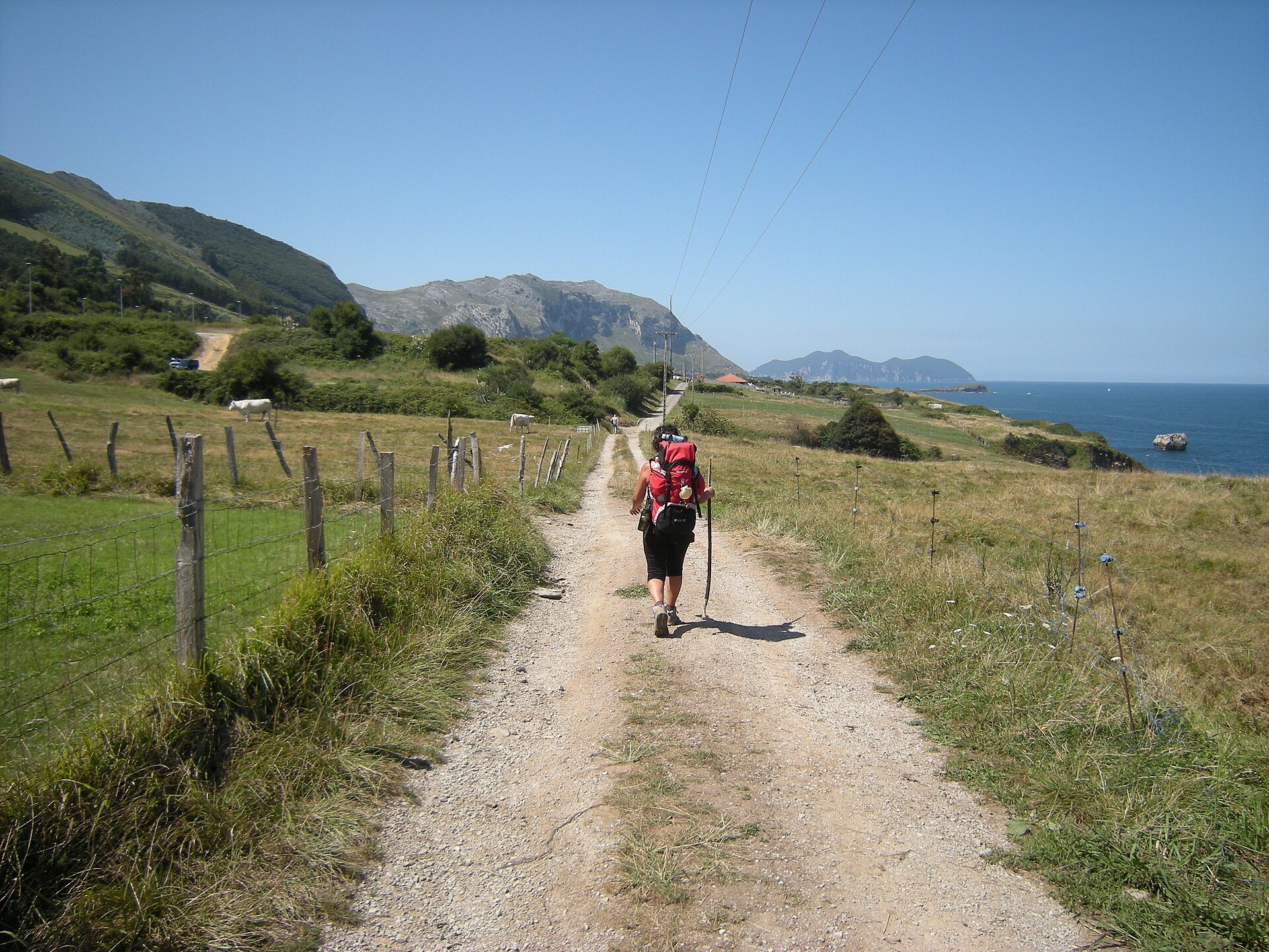
Photo: José Antonio Gil Martínez · Wikimedia Commons · CC BY 2.0

Camino del Norte
FRESThe Northern Way, also called the Coastal Way, is one of the routes of the Camino de Santiago. It is an 817 kilometres (508 mi), five-week coastal route from Irún (Gipuzkoa), near the border with France, following the northern coastline of Spain into Galicia where it heads inland towards Santiago de Compostela joining the French Way at Arzúa. This route follows the old Roman road, the Via Agrippa –which was used in the Middle Ages by Christian pilgrims when Muslim domination had extended northwards and was making travel along the French Way dangerous – for some of its way. The Northern Way coincides with the E9 European long distance path for most of its route.
Stages
| 1 | Bayonne → Iratzea | 20.5 km | ↗ 259 m |
| 2 | Iratzea → Irun | 21.7 km | ↗ 267 m |
| 3 | Irun → Pasaia | 17 km | ↗ 630 m |
| 4 | Pasaia → Igeldo | 14.2 km | ↗ 584 m |
| 5 | Igeldo → Getaria | 21 km | ↗ 522 m |
| 6 | Getaria → Deba | 15.8 km | ↗ 628 m |
| 7 | Deba → Arnoate | 15.4 km | ↗ 744 m |
| 8 | Arnoate → Ziortza-Bolibar | 16.5 km | ↗ 491 m |
| 9 | Ziortza-Bolibar → Gernika-Lumo | 19.1 km | ↗ 564 m |
| 10 | Gernika-Lumo → Larrabetzu | 16.5 km | ↗ 523 m |
| 11 | Larrabetzu → Bilbao | 16.2 km | ↗ 372 m |
| 12 | Bilbao → Sestao | 16.9 km | ↗ 476 m |
| 13 | Sestao → Muskiz | 18.2 km | ↗ 288 m |
| 14 | Muskiz → Castro-Urdiales | 18.3 km | ↗ 407 m |
| 15 | Castro-Urdiales → Lugarejos | 18 km | ↗ 367 m |
| 16 | Lugarejos → Santoña | 18.6 km | ↗ 269 m |
| 17 | Santoña → Ajo | 18.7 km | ↗ 286 m |
| 18 | Ajo → Somo | 18 km | ↗ 222 m |
| 19 | Somo → Arce | 24.1 km | ↗ 202 m |
| 20 | Arce → Santillana del Mar | 20.8 km | ↗ 319 m |
| 21 | Santillana del Mar → La Iglesia | 16.7 km | ↗ 341 m |
| 22 | La Iglesia → San Vicente de la Barquera | 16.5 km | ↗ 311 m |
| 23 | San Vicente de la Barquera → Colombres | 16.9 km | ↗ 378 m |
| 24 | Colombres → Llanes | 21.6 km | ↗ 202 m |
| 25 | Llanes → Güergu | 17 km | ↗ 219 m |
| 26 | Güergu → Sebreñu | 16.5 km | ↗ 165 m |
| 27 | Sebreñu → Colunga | 17.6 km | ↗ 344 m |
| 28 | Colunga → Casquita | 20.9 km | ↗ 356 m |
| 29 | Casquita → El Curviellu | 14.7 km | ↗ 648 m |
| 30 | El Curviellu → El Pozón | 18.9 km | ↗ 156 m |
| 31 | El Pozón → Avilés | 18.5 km | ↗ 144 m |
| 32 | Avilés → Sotu | 19.4 km | ↗ 425 m |
| 33 | Sotu → Artéu | 15.3 km | ↗ 401 m |
| 34 | Artéu → Argumosu | 15.5 km | ↗ 732 m |
| 35 | Argumosu → Caroyas | 17.1 km | ↗ 296 m |
| 36 | Caroyas → La Pena | 20.3 km | ↗ 336 m |
| 37 | La Pena → A Molle | 20.8 km | ↗ 273 m |
| 38 | A Molle → Ribadeo | 18.5 km | ↗ 127 m |
| 39 | Ribadeo → Vilamartín Grande | 17.9 km | ↗ 595 m |
| 40 | Vilamartín Grande → Mondoñedo | 17.6 km | ↗ 415 m |
| 41 | Mondoñedo → Abadín | 16.7 km | ↗ 647 m |
| 42 | Abadín → Vilalba | 20.6 km | ↗ 215 m |
| 43 | Vilalba → Baamonde | 19.1 km | ↗ 199 m |
| 44 | Baamonde → A Devesa | 19.7 km | ↗ 299 m |
| 45 | A Devesa → Sobrado | 20.4 km | ↗ 307 m |
| 46 | Sobrado → Arzúa | 21.9 km | ↗ 220 m |